Cartographica Neerlandica Background for Ortelius Map No. 57
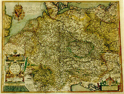
Title: Deutschlanndt | GER:|MANI:|AE TY:|PVS. | "Per Franciscum Hogenbergium concinnatus | Anno partæ salutis MDLXXVI | Vbiorum Coloniæ.| Cum Gratia et Priuilegio."[A Map of Deutschland, Germany, compiled by Franciscus Hogenberg, in the year 1576 from Cologne of the Ubii]. (Cartouche bottom right corner:) Magnifico, Nobili, ac Præcellentj viro ac Do:|mino, D. Constantino a Lijskirchen, florentis:|simæ Agrippinensis Reipub. Consuli Seni:|ori, Franciscus Hogenbergius nuncupat. [Dedicated] to the magnificent, noble and very excellent man and lord D. Constantinus of Lijskirchen, Senior Councillor of the most flourishing Cologne republic, by Franciscus Hogenberg].
Plate size: 381 x 490 mm
Scale: 1 : 3,000,000
Identification number: Ort 57 (Koeman/Meurer: 147, not in Karrow, van der Krogt AN: 2000:31B).
Occurrence in Theatrum editions and page number:
1602G36 (250 copies printed) (last line, centred like 6 lines above it, in Gothic script like the entire text: die wir nicht gesehen haben.)
1603L36 (300 copies printed) (last line, left aligned: Hæc,& plura, de hac regione atque gente, ibidem,cui lubet, legere potest.),
1606E33 (300 copies printed) (last line, left aligned: much and more concerning this people and countrey, who list may reade in the same authour.),
1608/1612I40 (300 copies printed) (last line, left aligned: piu altre di questa regione & gente , iui puote ciascun legger à piacere.),
1609/1612L39 (300 copies printed) (last line, left aligned: Hæc,& plura,de hac regione atque gente,ibidem,cui lubet, legere potest.),
1609/1612/1641S38 (325 copies printed) (last line, left aligned: de la gente,puede lo leer en otro parte.).
Approximate number of copies printed: 1775.
States: 57.1 as described.
57.2: in 1606 the sea behind "OCEANVS GER|MANICVS" received stippling.
57.3: after 1612S, we find below the cartouche and above the privilege "Theodorus Galle excudit Antuerpiæ", with Spanish text on verso.
Cartographic sources: Frans Hogenberg (1538-1590), who engraved many of the plates for the Theatrum, produced in 1576 a single sheet map of Germany which was published in Cologne. Possibly, some Theatrum copies earlier than 1603 also contain this map (Meurer p. 169-170).
References: P.H. Meurer: "Abraham Ortelius' Concept and Map of 'Germania'", p. 263-270 in M. van den Broecke, P. van der Krogt and P.H. Meurer (eds) "Abraham Ortelius and the First Atlas", HES Publishers, 1998.
For questions/comments concerning this page, please e-mail info@orteliusmaps.com.