Cartographica Neerlandica Background for Ortelius Map No. 27
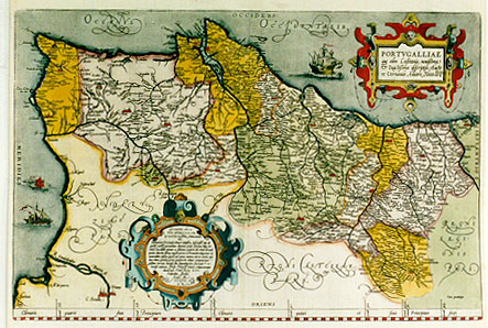
Title: PORTVGALLIĆ/quć olim Lusitania, novissima/& exactissima descriptio, Aucto/re Vernando Aluaro Secco [= A very new and exact depiction of Portugal, once called Lusitania, by Vernandus Alvarus Secco] (bottom right corner:) Cum priuilegio [= With privilege] (low left of middle cartouche with 17 lines of text:) GVIDONI ASCA/...Anno MCCCCCLX.
Plate size: 344 x 514 mm
Scale: 1 : 1,200,000
Identification number: Ort 27.
Remarks: when I published the book "Ortelius Atlas Maps" in 1996, I encouraged readers to send me information on new plates and new states not described in my book. As a result, I have received much information on new states and found quite a few myself as well, which have meanwhile been incorporated on my website.
However, inventive and meticulous research by Joe Q. Walker, in this particular instance assisted by David Bannister, has demonstrated that I postulated too many new plates, rather than too few.
When I postulated in 1996 a new plate Ort 27 Portugalliae my main argument for deciding that this was a new plate consisted of the fact that this offprint Ort 27 showed small blocks of diagonal hachuring, where Ort 26 showed vertical hachuring. I assumed that it was technically not feasible to erase such small patches of vertical hachuring on the copperplate and replace these patches with diagonal hachuring. The observation was correct but the conclusion was wrong. Walker has demonstrated that the new hachuring was applied on top of the old one. He also demonstrates that plate blemishes such as scratches and spurious dots occurring on Ort 26 also occurred on plate Ort 27. Therefore, the existence of a separate plate Ort 27 cannot be upheld. Walker has published the arguments leading to this conclusion in detail in a monograph "The Maps of Ortelius and their Variants", Antiquarian Maps Research Monographs - 1, which can be obtained from him on request through Email Martran@msn.com
I am happy that I have been informed about this research, since it increases our knowledge on Ortelius' maps.
No map text available
No bibliographical sources available
No topographical names available
For questions/comments concerning this page, please e-mail info@orteliusmaps.com.
The software that generates this website is available for sale. For more information, contact Thomer M. Gil.
This page has been generated on Tue Nov 18 09:47:46 2008.