Cartographica Neerlandica Background for Ortelius Map No. 132
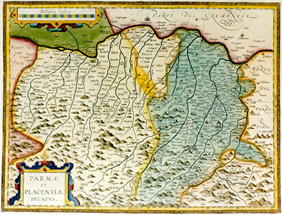
Title: PARMĆ | ET | PLACENTIĆ | DVCATVS. [The duchy of Parma and Piacenze].
Plate size: 366 x 482 mm.
Scale: 1 : 270,000
Identification number: Ort 132 (Koeman/Meurer: 156, not in Karrow, vdKrogtAN: 7250:31).
Occurrence in Theatrum editions and page number:
1608/1612I91 (300 copies printed) (last line, left aligned: & altri.),
1609L/1612L91 (300 copies printed) (last line, left aligned: norum qui plura volet,consulat Blondum,Platinam,Corium,Leandrum, aliosque.),
1609/1612/1641S91 (325 copies printed) (last line, left aligned: Leandro Alberto,Platina,el Corio,y otros autores que della escriuen.).
Approximate number of copies printed: 925.
States: 132.1a: two versions of an early state occur where the top left is empty at the spot where we later find the mile scale. The top right is also empty, as if a cartouche is planned there, and the bottom left is also empty. The two copies I have inspected of this state both have Latin text of the 1609/1612L edition.
132.1b Another early state has the title cartouche hand-drawn, including the lettering, but smaller than the cartouche which appears in the next state. At the spot where regular prints have a cartouche at the left top with Miliara Italica there is a much smaller, empty cartouche. The text on verso is of the 1608/1612I edition. All Italian 1608/1612 and some Latin 1609/1612 editions show state 132.1.
132.2 in the course of 1609 a cartouche filled with text appeared in the lower left corner and a mile scale appeared in the upper left corner. Numerous place names have now been added or changed.
132.3 in the 1641 Spanish edition, the coordinates in the upper and lower map edge have been changed. First they ranged from [31]30 to [32]50, now from [31]40 to [33]0. This means that the degrees along the horizontal parts of the frame were moved about 10 minutes to the west.
Cartographic sources: this map is based on the single sheet map of the Piacenze and Parma area which Giovanni Antonio Magini (1555-1617) drew around 1600 (Meurer p. 18-189).
Remarks: note the erroneous "l" in "Placentiae", also occurring in de Jode's 1578 map of "PLAISANTIĆ".
For questions/comments concerning this page, please e-mail info@orteliusmaps.com.